THE ROSELAND PLAN
  • Home
  • What's Happening
    • Minutes of Meetings >
      • Management Team Minutes
      • Steering Group Minutes
  • Who's Who
  • The Plan
    • The Roseland Plan
    • Conformity Statement
    • Appendices >
      • Appendix 1 - Settlement Boundary Maps
      • Appendix 2 - Roseland Development Checklist
      • Appendix 3 - Development Management Toolkit
      • Appendix 4 - Potential Project List
    • Roseland Character Documents >
      • Roseland Area Profile
      • Roseland Local Landscape Character Assessment
      • Roseland Maps of Agricultural Land Quality, Flood Zones etc
      • Roseland Character Document
    • Roseland Plan Design Guide
    • Documents Submitted with The Plan >
      • The Basic Conditions Statement >
        • Sustainability Assessment
        • Equality Impact Assessment
      • The Consultation Statement
      • Proposals Maps
    • The Examiner's Report
    • Background Material >
      • What is a Neighbourhood Plan?
      • Producing a Neighbourhood Plan
      • The Roseland NDP >
        • Terms of Reference
        • Philosophy
        • Organisation
        • Early Days of The Plan
        • Community Engagement Strategy
        • Mapping Exercise
        • Project Plan
        • The Evolving Project Plan
        • Progress
        • Procedures Used
  • Implementation
    • Implementation Project Plan
    • Planning Assessment and Monitoring >
      • Planning Assessment Group Minutes
      • Planning Assessment Group Conformity / Non-Conformity Letters
    • Affordable Housing for The Roseland
    • Conservation Area Management Plans >
      • Conservation Area Team Minutes
    • Wild Roseland Project >
      • Wild Roseland Group Minutes
    • Effectiveness Review
  • Contact Us
Proposals Maps
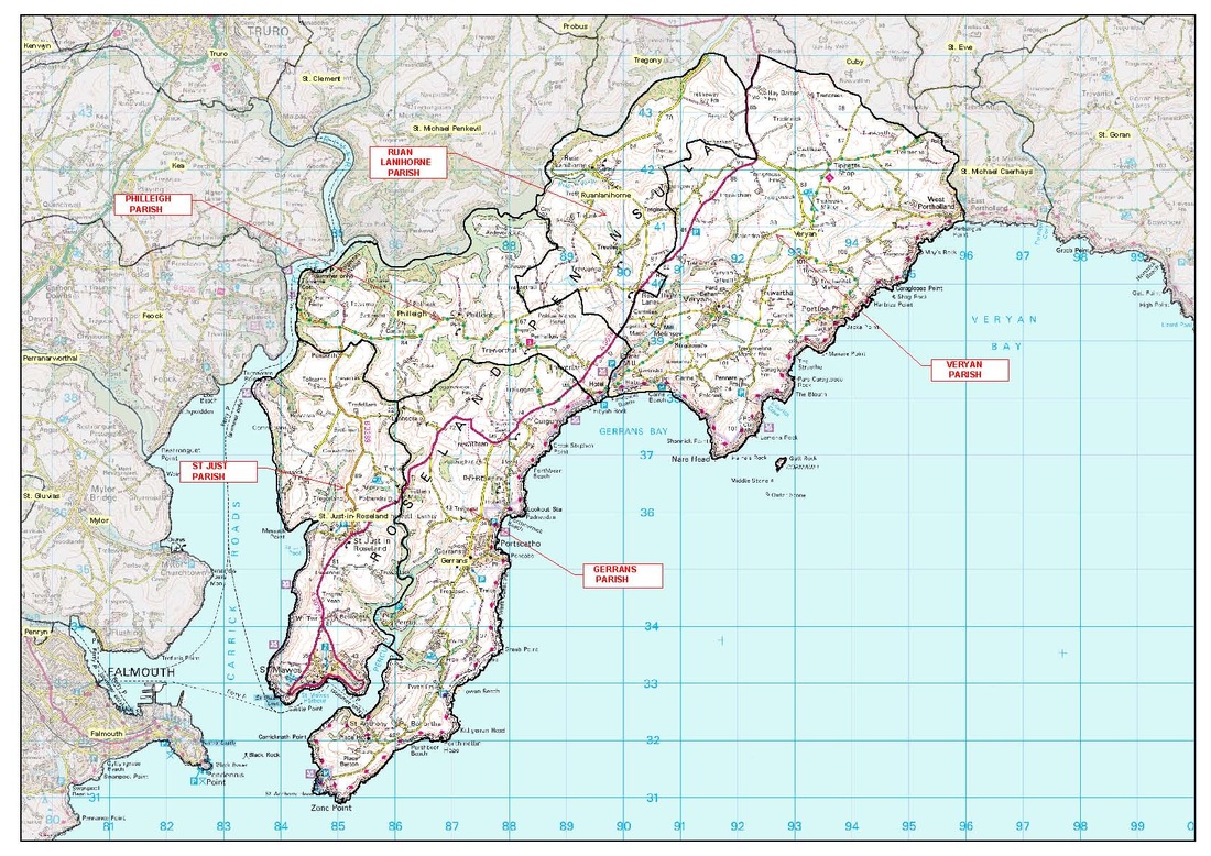
Below you can download a map of the Plan Area which also indicates the Area of Outstanding Natural Beauty, the Fal and Helford Special Area of Conservation and SSSIs.

map_showing_the_5_parishes_the_aonb_the_sac_and_sssis.pdf
File Size: 2887 kb
File Type: pdf
Download File

Below you can download maps of the settlements with Conservation Areas and Settlement Boundaries.
gerrans-portscatho_conservation_area_and_settlement_boundary_a4p.pdf
File Size: 426 kb
File Type: pdf
Download File

portloe_conservation_area_and_settlement_boundary_a4p.pdf
File Size: 307 kb
File Type: pdf
Download File

st_just-in-roseland_conservation_area_and_settlement_boundary_a4p.pdf
File Size: 234 kb
File Type: pdf
Download File

st_mawes_conservation_area_and_settlement_boundary_a3l.pdf
File Size: 541 kb
File Type: pdf
Download File

veryan_conservation_area_and_settlement_boundary_a4p.pdf
File Size: 315 kb
File Type: pdf
Download File

veryan_green_conservation_area_and_settlement_boundary_a4p.pdf
File Size: 262 kb
File Type: pdf
Download File

Picture
Created by Ecanus Design
Proudly powered by Weebly